







roľnícka usadlosť Farmer's farmstead
Slovak cultural monument - peasant settlement in Osturne
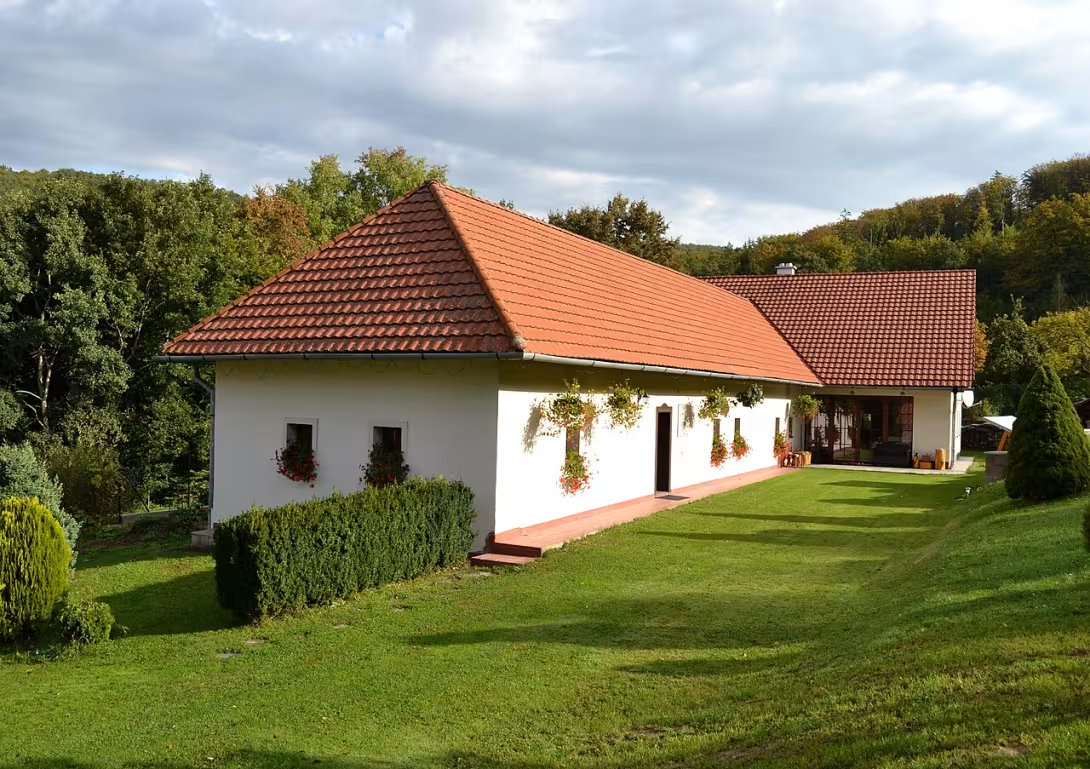
The area registers the Monument Office of the Slovak Republic under the number of the ÚZPF 10316 and consists of 4 objects: Stodola with stable, Construction Economic, Folk House and Construction Economic i.
This court is a national cultural monument of the Slovak Republic. Located in the village Osturňa, Prešov region, with GPS coordinates 49.33616, 20.26006.
The complex consists of 4 objects: Barn with stable (rub construction, folk construction, around 1955), Construction economic (rub construction, folk construction, after 1945), House folk (rub construction, folk construction, after 1945) and Construction economic (rub construction, folk construction, after 1945).
Building characteristics of the complex is a log structure with folk construction. The layout and flooring of objects varies.
Poloa and protection: address No 57, Osturňa; cadastral territory Prešov region; date of declaration for monument 1990.
The current state of the area is preserved, used as a residential building.
Tehdy a dnes
Drag the slider and compare how the monument might have looked when it was built with the view today.
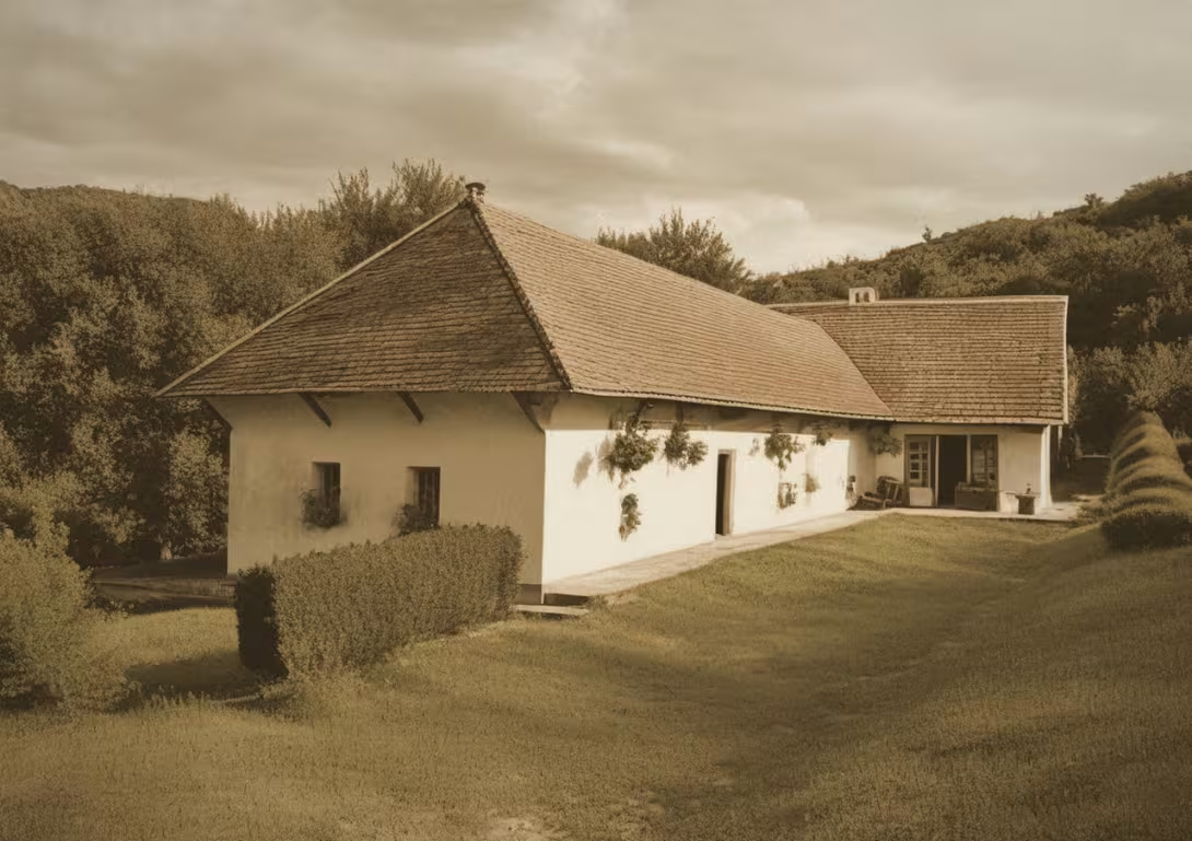
The historical view on the left is a visualisation generated by artificial intelligence and serves as inspiration.
Historical Milestones
- after 1945
- Creation of economic buildings and folk house
- about 1955
- Building a barn with a stable
- 1990
- Declaration of the area as a national cultural monument
Guide
Show guide text
The text was prepared by artificial intelligence and has not been editorially reviewed. It may contain inaccuracies.
Good day! You stand before this peasant settlement in Osturni, Prešov region. You have before you the original residence of the peasant families who lived and managed here.
This farmyard has its rich history, although its beginnings are unknown to us. All we know is that it was built in someone's old age. The architect of the residence is typical of this area and contains elements that are characteristic of the farm settlements of this area.
You will notice how the yard opens on the surrounding fields and forests. This was why farmers lived here - to manage and procure their needs. It's all like we've moved to the past and seen people live here.
Many wonderful history has arisen about the people who lived here. One of them is about the farmer who lived here. He was a man who was very proud and tried to give his village the best. It's all like we've moved to the past and seen people live and manage.
To the point that there is someone who was very interesting. He was a man who had a lot of intentions and tried to give his village the best. It's all like we've moved to the past and seen people live and manage.
To the point that there is someone who was very interesting. He was a man who had a lot of intentions and tried to give his village the best. It's all like we've moved to the past and seen people live and manage.
Let's just say there's someone here who was very interesting. He was a man who had a lot of intentions and tried to give his village the best. It's all like we've moved to the past and seen people live and manage.
To the point that there is someone who was very interesting. He was a man who had a lot of intentions and tried to give his village the best. It's all like we've moved to the past and seen people live and manage.
It's all like we've moved to the past and seen people live and manage.
Frequently asked questions
Can the monument be visited?
This is a residential or farm building, not a museum with opening hours. Please view it from public space and respect the owners' privacy. We have no information about access to the interior.
Where is the monument?
Location: č. 57, Osturňa, Prešovský kraj. The map on this page shows the exact spot.
Why is the monument protected?
It is listed in the Central List of the Monuments Fund of the Slovak Republic as a national cultural monument (ÚZPF no. 413-10316).
For children
Monument: peasant settlement
Imagine that time will stop for a while. You don't want to be at school and you don't know what to do with your free time. You want to have a real adventure. You close your eyes and when you open them again, you're no longer in peace. You stand in the middle of beautiful mountains where the air smells like fresh wood and freshly cut grass.
Nearby
🏰 Historic sites (38)
- 700 r. obce 1.9 km
- Padlým rodákom v 1. sv vojne 1.9 km
- Ždiarsky dom 7.3 km web
- Penzión Tatra 7.5 km
- Szałasy 7.9 km
- Pomnik strażaków 8.4 km
- dom Michal Dočolomanský 8.6 km
- Zagroda Sołtysów w Jurgowie 8.9 km web
- Izba Regionalna 9.6 km Księdza Józefa Kosibowicza 13 +48 694477544
- Druhnie Oldze Małkowskiej 9.9 km
- Miejsce dawnego dworu obronnego 10.3 km
- Wozownia 10.4 km
- Zamek Dunajec 10.5 km web
- Zamek Dunajec 10.5 km
- Zagroda Korkoszów w Czarnej Górze 10.8 km Zagóra 86 web
- Lovecký zámoček Hohenlohe 11.0 km +421 905 243 618 web
- Pawilon wejściowy w Sromowcach Wyżnych - Kątach 11.1 km
- Zamek Czorsztyn 11.6 km web
- Zamek Czorsztyn 11.6 km
- Kościół pw. Świętej Elżbiety Węgierskiej (dawny) 11.9 km
🍽️ Restaurants and dining (145)
- Mocova Koliba Pohostinstvo Pavlik Ján 2.1 km +421 911 835 392 web
- Pohostinstvo u Emila 2.4 km
- Pizzeria Francesco 4.8 km Świętej Anny 122
- Reštaurácia Medvedí brloh Strachan 6.8 km +421919171519 web
- Penzión Kamzík 6.9 km
- Panorama 6.9 km web
- Penzión Ždiaranka 6.9 km +421910999571 web
- Penzion Strachan 6.9 km
- Hniezdo 7.0 km
- Restauracja "Nowak" 7.0 km web
- Hotel Sova Ždiar 7.1 km +421 905 926 601 web
- Pizzeria Rustika 7.1 km
- Bufet Livia 7.2 km
- Reštaurácia Goral 7.3 km
- Ždiarsky dom 7.3 km
- Ždiaran 7.3 km web
- Bistro Strednica 7.3 km
- Tulipub 7.7 km Hlavná 76/45 +421 949 772 039 web
- Espresso 7.8 km +421 902 390 460
- Harwań 7.8 km Podokólne 1
🏨 Accommodation (321)
- Ubytovanie U Emila 2.4 km
- Chata Goral 3.5 km web
- Luxury Chalet Katarinka 4.0 km +421 904 512 113 web
- Pokoje u Danki 4.5 km +48885586899
- Domki pod Sosnami 5.3 km Jutrzenki 21
- Harnaś 5.5 km Świętej Anny
- No Name Luxury Hotel & Spa 5.7 km Leśna 46 +48 797 502 141 web
- Hanus 6.2 km
- Vila Janka 6.3 km Spišské Hanušovce 72 web
- Chata Dana 6.7 km +421905177522
- U Rezbára 6.8 km +421 905 315 658
- Penzion Safran 6.8 km
- Penzión u Pavla 6.8 km +421 907 583 815 web
- Penzión Slovakia 6.8 km web
- Penzión Ždiaranka 6.9 km +421910999571 web
- Penzion Patrik 6.9 km
- Mountain Resort Apartments 6.9 km +421 911 109 202 web
- Chalúpka 420 6.9 km web
- Penzion Viktoria 6.9 km
- Penzión Michal 6.9 km
🚲 Rentals and sport (38)
- E-bike Strachan 7.4 km web
- Centrum Rekreacji i Wypoczynku "HAWRAŃ" Sp. z o.o. 7.8 km Podokólne 1 +48 696 232 312 web
- wypożyczalnia i szkoła narciarska Ski-Plus 7.9 km Podokólne 1
- przystań statków "Dunajec" i "Halny" 10.5 km
- przystań gondoli "Czorsztynianka" 10.5 km
- Przystań źeglarska 10.6 km
- Prístav Pltí 10.7 km web
- Przystań Spływu Dunajcem 11.1 km
- Przystań gondoli "Czorsztynianka" 11.7 km
- Prístav Pltí 11.8 km
- Prístav pltí Červený kláštor 11.8 km web
- Vito 11.8 km Stylchyn 94
- PTŻ 11.9 km Stylchyn 36 +48 530 523 433 web
- FUN SPORT 11.9 km Sportowa 14
- corny staw 12.1 km
- Letnie mocydełko 12.1 km
- cepersko płań 12.1 km
- jaskinia nad Porońcem 12.1 km
- Marina Kluszkowce 12.3 km Przedszkolaków 3 +48 609 264 633 web
- WyskoczNa 12.3 km
🥾 Hiking and nature (384)
- Vŕšok 0.5 km
- Rohová 1.1 km
- Malorovka 1.6 km
- Petrolovka 1.7 km
- Kubuś 1.9 km
- Zlomiská 2.1 km
- Rezerwat Niebieska Dolina 2.5 km
- Tylki Hawiarskie 2.5 km
- Línia zákopov z 2. svetovej vojny 2.6 km
- Poľana 2.7 km
- Klęzbarg 2.8 km
- Línia zákopov z 2. svetovej vojny 2.9 km
- Pod Koszary 3.0 km
- Pieskowy Wierch 3.1 km
- Lipia Góra 3.1 km
- Hora 3.2 km
- Winterłajd 3.2 km
- Kunia 3.3 km
- Línia zákopov z 2. svetovej vojny 3.3 km
- Solisko 3.5 km
Thematic route
Osturna - farming settlement and surroundings
The route begins in the center of Osturňa, where there is a peasant settlement Dvor peasantsky.
1. The farmyard - it is possible to see the walls, roofs and interiors of this settlement. 2. Railway station Osturňa - located a few minutes walk from the courtyard. It's a 19th-century building. 3. Church of St. Nicholas - located in the center of the village.
The total length of the route is approximately 1.5 km.
Visualisations and artistic views


The visualisations are generated by artificial intelligence and serve as inspiration.
Photographs from the area
Real photos taken near the monument


Source and licence are given for each image.
Visitor Tips
No tips yet. Be the first!
Log in and add your tip.
Location on Map
More monuments – Osturňa
Show all in the town


Visitor photos
No photos yet. Be the first to add a photo from your visit!
Log in and add your photo or leave a rating.
You get more points for a visit verified in the app — we can tell from the GPS that you are there.
Reviews and comments